Directions to Country Place on the Shenandoah River
Follow these directions to find usCountry Place on the Shenandoah

Country Place Lodging & Camping on the Shenandoah River
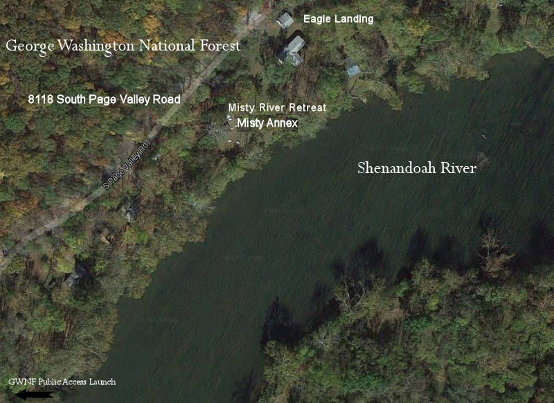
Misty River Retreat
Captain’s Lodge on the Rapids

Captain”s Lodge on the Rapids
Base Camp, Sanctuary Treehouse and River Camp Address:
400 Fort Liscomb Road Luray VA 22835
Specific directions to each Cabin, Lodge and tree house are sent at reservation.
The Country Place is 100 miles west of Washington, D.C., 135 miles from Richmond, 66 miles from Charlottesville, 40 miles from Harrisonburg, 240 miles from Philadelphia, 135 miles from Baltimore, 2700 miles from San Francisco, and airplane rides from Hawaii and Mexico.
From Route 66 West:
Go approximately 67 miles on Interstate 66. Take EXIT 13 to LINDEN. Turn LEFT at exit stop sign onto VA-79/APPLE MOUNTAIN RD.
Go under Interstate 66. Go .2 mile turn RIGHT at dead-end in front of and to the left of gas stations onto VA-55/JOHN MARSHALL HWY.
Continue to follow VA-55 West. 5.2 miles to dead-end at traffic light. Turn LEFT onto US-340/S ROYAL AVE. Continue to follow US-340 S. 22.9 miles US-340 S becomes US-340 BR S/N BROAD ST. just north of Luray.
Just after passing under the Route 211 overpass, turn right onto Mechanic Street (about a city block before downtown Luray intersection/traffic light).
Note that MECHANIC ST becomes BIXLERS FERRY RD. (.9 mile) Stay on BIXLERS FERRY RD. as it winds and crosses over a bridge over the Shenandoah River and then dead-ends. (1.7 mile) Turn RIGHT onto S PAGE VALLEY RD/VA-684. Continue to follow S PAGE VALLEY RD. 7 miles.
For the Sanctuary Tree House, Base or River Camps, and Country Place Office:
- Turn RIGHT at the Country Place Camp sign onto FORT LISCOMB RD (a gravel dirt lane) just after passing the Shenandoah River Outfitters.
- To go to the lodge or cabins (all within a mile), refer to the address and directions on the Word document sent with reservation.
From New York, Pennsylvania, or the South and West:
Take Interstate 81 to New Market. Follow Route 211 East. Turn left at Route 652/Airport Road (immediately after the Rainbow Hill Gift Shop and Restaurant on right).
Note, if you intend to go grocery shopping, continue on 211 East just half a mile more (The Food Lion Shopping Plaza and Wal-Mart Super Store are on your left).
Return west to Airport Road, continue 2 miles on a winding road around the airport, turn left at the stop sign at Bixlers Ferry Road.
From the Virginia Beach, Norfolk, Richmond Areas:
Get on 64 East. Before getting to Charlottesville, take the Route 15/ Zions Crossroads exit. At exit stop, turn right onto 15 North. At Gordonsville, go 3/4 way around a traffic circle to head West on Route 33. Stay on 33 past Routes 20, 29, up and over the Blue Ridge Mountains until you come to the town of Elkton/Route 340 exit. Turn right onto 340 North (a Pizza Hut is on your right). Travel about 12 miles (do not take the 340 Business/ Stanley exit to the right.) Route 340 North is named Battlecreek Road and deadends on Route 211. Massanutten Mountain is on your left; the Blue Ridge Mountains are on your right this entire drive.
Follow Route 211 East, crossing over the Shenandoah River. Turn left at Route 652/Airport Road (immediately after the Rainbow Hill Gift Shop and Restaurant on right). If you intend to grocery shop, continue on 211 East just half a mile more (The Food Lion Shopping Plaza and Wal-Mart Super Store are on your left). Return west to Airport Road, continue 2 miles on a winding road around the airport, turn left at the stop sign at Bixlers Ferry Road.
Stay on BIXLERS FERRY RD. as it winds and crosses over a bridge over the Shenandoah River and then dead-ends. (1.7 mile) Turn RIGHT onto S PAGE VALLEY RD/VA-684. Continue to follow S PAGE VALLEY RD. 7 miles. For cabins, then follow the directions sent with your reservation package. For the Sanctuary Tree House, Base or River Camps, and Country Place Office: turn RIGHT at the Country Place Camp sign onto FORT LISCOMB RD (a gravel dirt lane) just after passing the Shenandoah River Outfitters.
From Charlottesville Area:
Take 29 North to 33 West. See Virginia Beach, etc. for rest of directions.
From Dulles Airport:
Take Dulles Road East toward DC. Take Route 128 Centerville Exit (second exit on right side after leaving airport terminal roads). Turn right onto 50 West. Travel until Route 66 West signs on right. Signage is at a traffic light. Be careful to go through traffic light to take the first immediate right. Then go to “From Route 66 West” above.